Log in
All resources
Create a design
255 Free Artworks of Maps Of New France
bibliothèque nationale de france
atlas, ou représentation du monde universel et des parties d'icelui, faicte en tables et descriptions très amples et exactes, divisé en deux tomes. édition nouvelle... - btv1b53103889w
university of washington
satirical prints in the british museum
paper
british museum
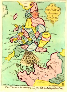
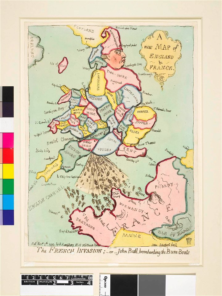
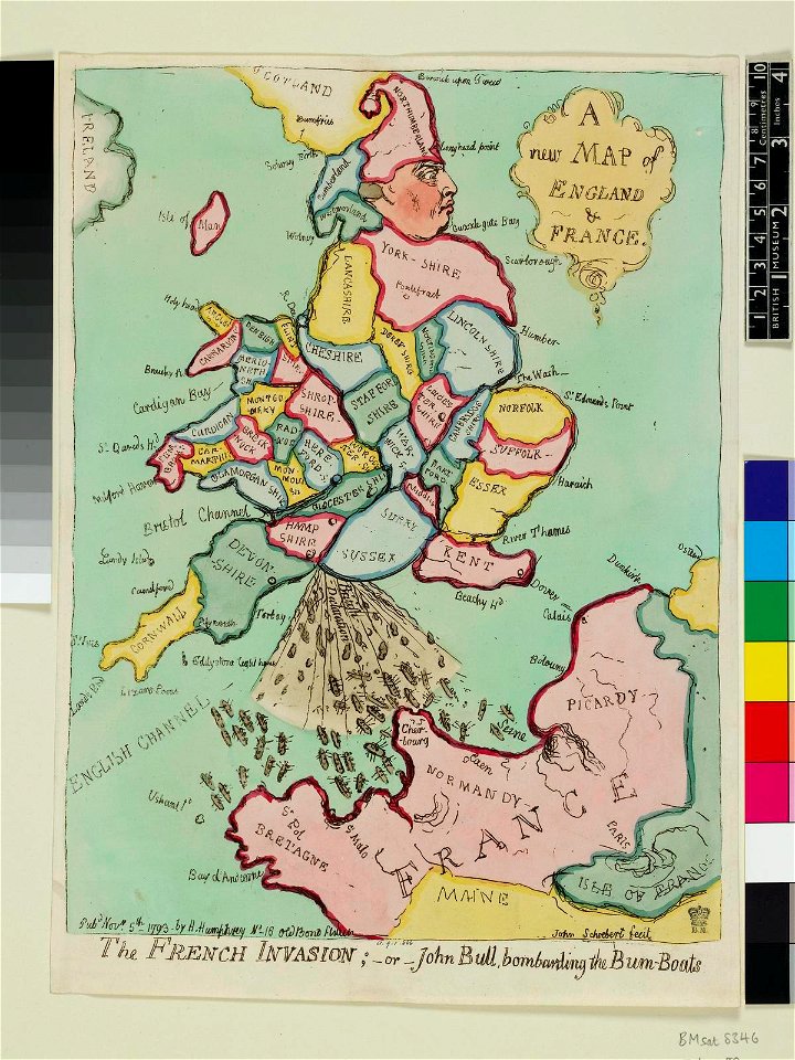
james gillray
prints by james gillray in the british museum
george iii, king of the united kingdom
philippe buache
a map of the british empire in america with the french and spanish settlements adjacent thereto
bibliothèque nationale de france
kaart van het nieuwe diep aan de helder - vervaardigtenk in july en augustus 1785, door leendert den berger ; leon.d schenk, jansz. sculpsit - btv1b53102961h
leonard schenk jansz.
kaart van het nieuwe diep aan de helder - vervaardigtenk in july en augustus 1785, door leendert den berger ; leon.d schenk, jansz. sculpsit - btv1b53102961h
leonard schenk jansz.
maps of limousin by jean fayen
gabriel tavernier
carte des régences d'alger by hérisson
bibliothèque nationale de france
carte des régences d'alger by hérisson
bibliothèque nationale de france
maps made in the 18th century
georg friedrich schmidt
atlas van der hagen (volume 3)
atlas van der hagen
bibliothèque nationale de france
hendrik de leth
bibliothèque nationale de france
guillaume sanson
1696 maps of the caribbean
1690s maps of mexico
prints by james gillray in the british museum
satirical prints in the british museum
prints by james gillray in the british museum
satirical prints in the british museum
prints by james gillray in the british museum
satirical prints in the british museum
prints by james gillray in the british museum
satirical prints in the british museum
atlas, ou représentation du monde universel et des parties d'icelui, faicte en tables et descriptions très amples et exactes, divisé en deux tomes. édition nouvelle... - btv1b53103889w
1630s maps of peru
atlas, ou représentation du monde universel et des parties d'icelui, faicte en tables et descriptions très amples et exactes, divisé en deux tomes. édition nouvelle... - btv1b53103889w
1630s maps of bavaria
john rocque's 1746 map of london
bibliothèque nationale de france
john rocque's 1746 map of london
bibliothèque nationale de france
atlas, ou représentation du monde universel et des parties d'icelui, faicte en tables et descriptions très amples et exactes, divisé en deux tomes. édition nouvelle... - btv1b53103889w
17th-century maps of guyana
old maps of mainz
baroque
mappe-monde geo-hydrographique (sanson and jaillot, 1674)
cartography of france
1740s maps of the americas
1747 maps of north america
atlas, ou représentation du monde universel et des parties d'icelui, faicte en tables et descriptions très amples et exactes, divisé en deux tomes. édition nouvelle... - btv1b53103889w
maps of the peloponnese by gerardus mercator
atlas, ou représentation du monde universel et des parties d'icelui, faicte en tables et descriptions très amples et exactes, divisé en deux tomes. édition nouvelle... - btv1b53103889w
17th-century maps of silesia
atlas, ou représentation du monde universel et des parties d'icelui, faicte en tables et descriptions très amples et exactes, divisé en deux tomes. édition nouvelle... - btv1b53103889w
maps of guinea by mercator-hondius
atlas, ou représentation du monde universel et des parties d'icelui, faicte en tables et descriptions très amples et exactes, divisé en deux tomes. édition nouvelle... - btv1b53103889w
maps of candia by ortelius and mercator
atlas, ou représentation du monde universel et des parties d'icelui, faicte en tables et descriptions très amples et exactes, divisé en deux tomes. édition nouvelle... - btv1b53103889w
17th-century maps of chile
atlas, ou représentation du monde universel et des parties d'icelui, faicte en tables et descriptions très amples et exactes, divisé en deux tomes. édition nouvelle... - btv1b53103889w
maps of waldeck by gerardus mercator
bibliothèque nationale de france
hendrik de leth
carte du mexique et de la floride by guillaume delisle (1703)
bibliothèque nationale de france
maps of the captaincy general of cuba
maps of the history of florida
the plumb-pudding in danger (cartoon)
caricatures of uniforms
maps of the iberian peninsula by guillaume delisle
1700s maps of the iberian peninsula
works by constantino brumidi
françois barbé-marbois
carte des côtes de malabar et de coromandel (1723)
philippe buache
mappe-monde geo-hydrographique (sanson and jaillot, 1674)
cartouches by guillaume delisle
philippe buache
carte de barbarie, nigritie, guinée par guillaume delisle (1707)
university of washington
carte de l'isle de ceylan by guillaume delisle (1722)
philippe buache
old maps of the viceroyalty of new spain
the spanish borderlands
carte de l'afrique françoise par guillaume delisle (1726)
philippe buache
map of europe by guillaume delisle (1700)
university of washington
carte de moscovie by guillaume de l'isle (1706)
university of washington
serie 4, franse, duitse en engelse gebeurtenissen, 1576-1610
album met 345 prenten van hogenberg
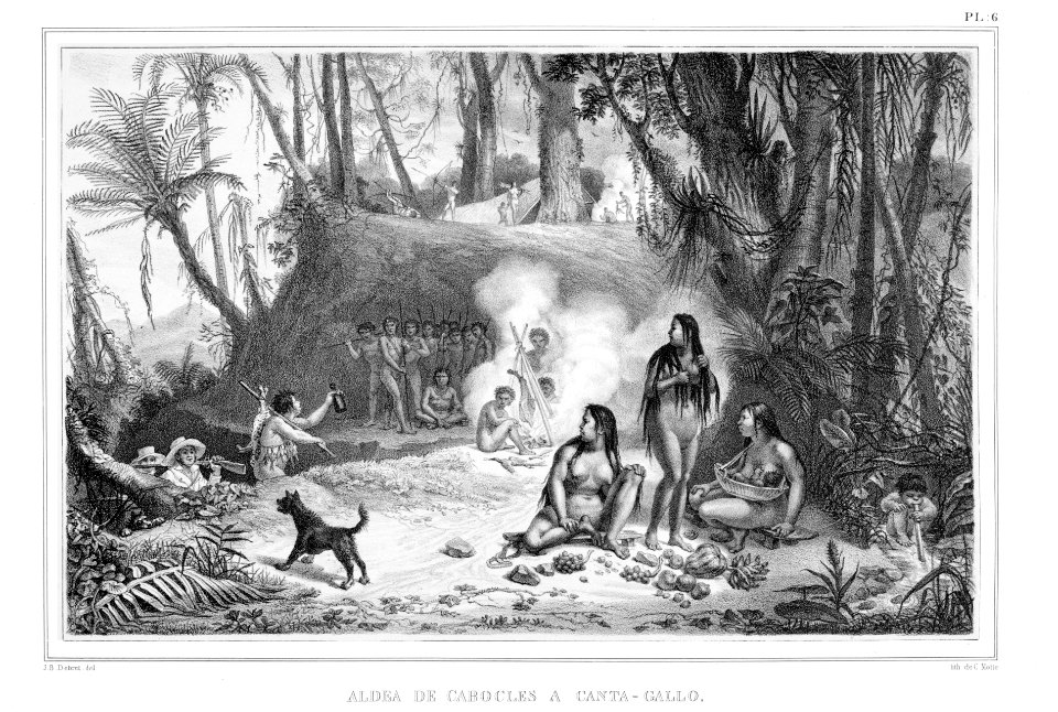
rio de janeiro by jean-baptiste debret
neoclassicism
1830s lithographs
neoclassicism
indigenous peoples of brazil in art
neoclassicism
documents of massachusetts
charles sumner
documents of massachusetts
charles sumner
documents of massachusetts
charles sumner
documents of massachusetts
charles sumner
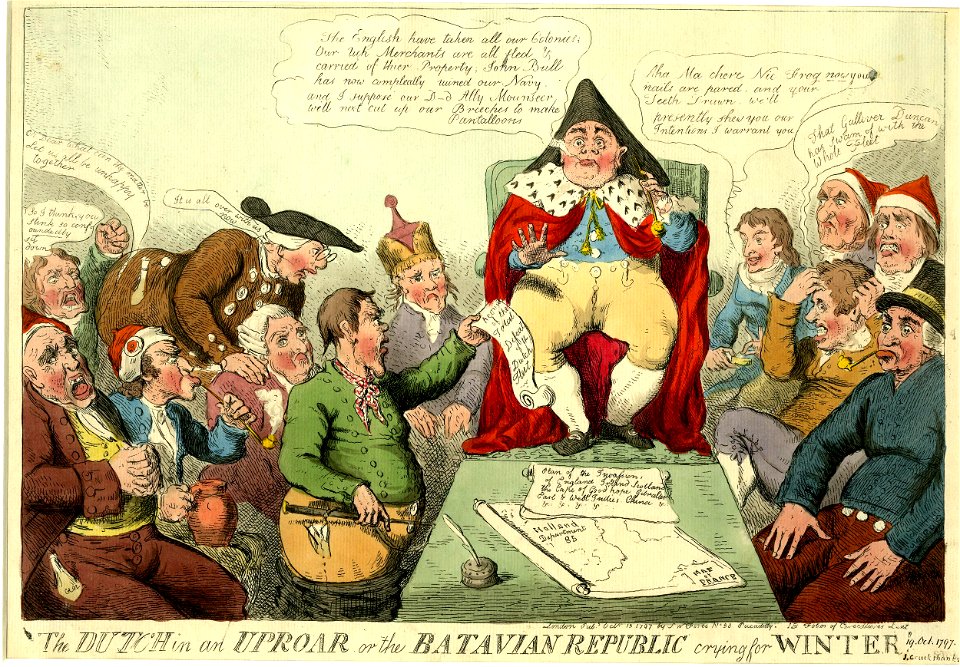
prints by isaac cruikshank in the british museum
satirical prints in the british museum
prints by james gillray in the british museum
satirical prints in the british museum
prints by isaac cruikshank in the british museum
satirical prints in the british museum
201 - 255 of 255
/ 3